It was built in 1860 on the site of an old bridge, which was destroyed. In 1863 it was rebuilt from the ground up, but collapsed almost on the opening day. In 1866 it was rebuilt, only to collapse again in 2015, due to heavy rainfall and poor maintenance in previous years. Its reconstruction began almost immediately, with the collection of debris from the river, and was completed in 2019, when it was once again handed over to the public.
During the 1880s, the Arachthos River was the natural border between Greece and the Ottoman Empire, and there was a customs office at that point.
In World War II the bridge was bombed by German forces, however it survived with only minor damage, to be repaired in 1943 by the locals with cement.
Near the bridge, on February 29, 1944, the Plaka - Myrophyllum agreement was signed between the resistance organizations ELAS, EDES and EKKA, as well as members of the allied military mission in Greece, with the aim of ending the civil conflict between the above organizations.
In recent years the bridge functioned as an attraction of the area, as its function had been replaced by a newer bridge a short distance away.
The bridge can be visited in all seasons. Visitors are led to this via a path that offers excellent views of the bridge and the river. Its top offers a stunning view of the Plaka gorge.
There is a cafe next to the bridge.
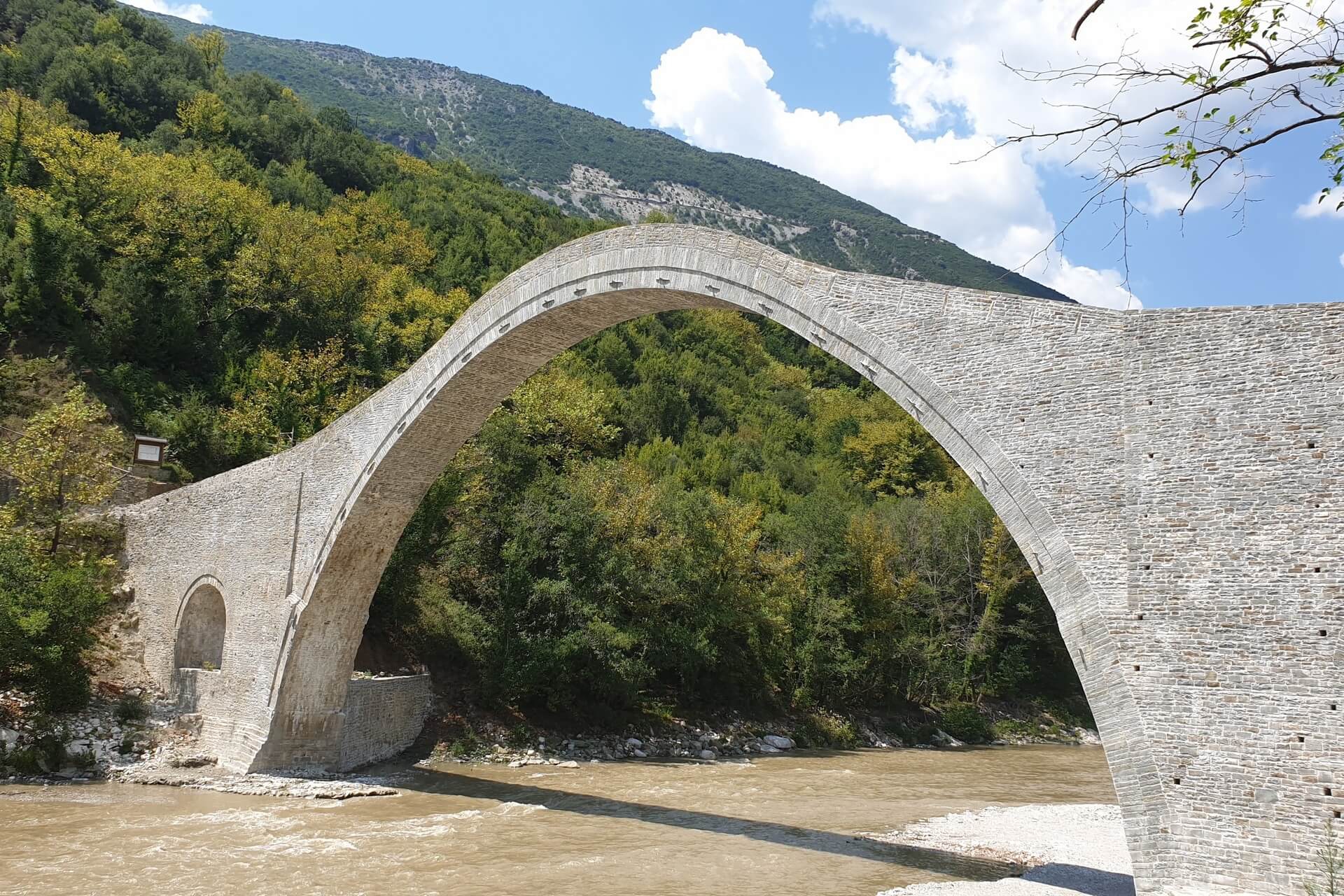
Plaka Historic Bridge
- Distance: 17,9 km
- Drive Time: 28'
- Type: Nature • History • Architecture
The historical bridge of Plaka is the largest single-arched bridge in the Balkans and the third largest in Europe. It has an arch span of 40 meters, a height of 21 meters and an opening at the top of 3.2 meters. It connects Tzoumerka with Katsanochoria and by extension the prefecture of Arta with the prefecture of Ioannina.
Image Gallery


View the embedded image gallery online at:
https://www.villalochia.gr/index.php/en/discover-tzoumerka/plaka-historic-bridge#sigProIdec5e0d3dab
https://www.villalochia.gr/index.php/en/discover-tzoumerka/plaka-historic-bridge#sigProIdec5e0d3dab